Hike to Olsberg and Heidkopf
Hiking in Olsberg (Sauerland)
Hike on the summit of the Olsberg and around the Heidkopf.
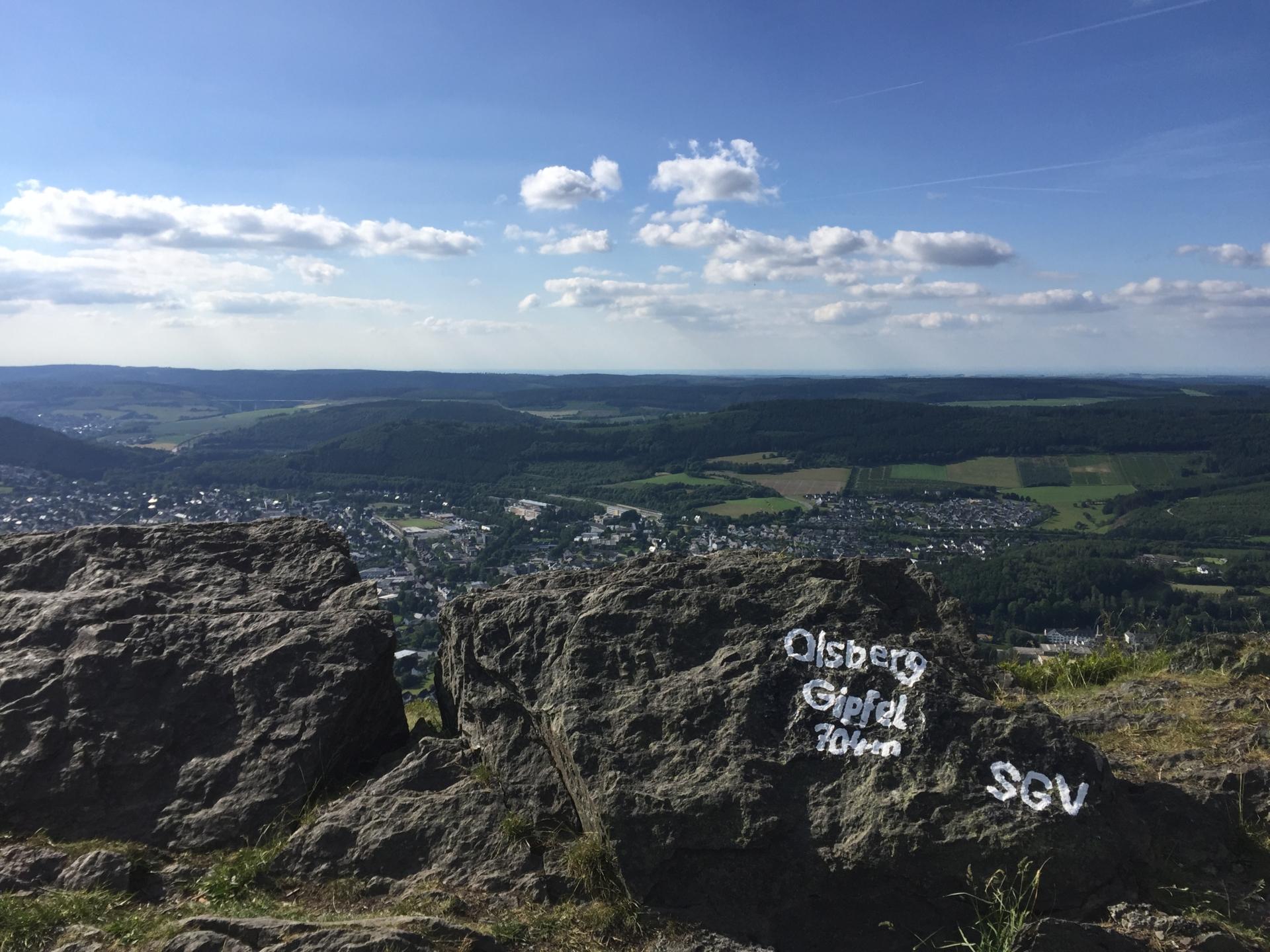
The summit of the Olsberg (704m) rewards every visitor with its wonderful panoramic view of the city of the same name. Also worth seeing is the circular route to the Heidkopf, from which you get a view of the Brauchhausen stones.
Tourdata
Directions
You start your tour at Drosselweg in Olsberg. Here it goes up the Olsberg. For this you go straight for the first hundred meters towards the mountain. At the first intersection, you choose the left path. Follow this until the first junction which leads you further up. The right turn is only a path and in some places it may not be quite firm. At the end of the path, turn left onto a dirt road and after a few meters, turn right. This path now leads you below the summit Olsberg and Heidkopf. After 3.7 km you come to a rest area where you can take a comfortable break and have a view of Bruchhausen and the Bruchhausen stones.
The further path now leads you up the mountain to the left. If you follow this, you will come to a right-hand junction after 1.7 km. This leads you back down to the path from which you once came. Now you go back a few meters and then up the path on the right. From a distance you can already see the WDR transmission tower, which you also walk past to get to the summit of the Olsberg. When you reach the top of the summit, you have a fantastic view of the small town.
The way back is now down some paths. To do this, hike down the meadow path to the left of the summit cross. This is also not constantly stable and also slightly overgrown. The path is well signposted (Olsberg summit path A3). After reaching the second gravel path, turn right to get back on the path from which you originally came. You follow this to the first path. Here you can either go back the path or stay on the gravel path. If you stay on the gravel path, go to the end and keep right towards Olsberg (in this case the city). After a few meters you will be back at the starting point.